
Thinking and Walking Around
If you haven’t spent much time in New York City, I wouldn’t blame you for thinking that New Yorkers care little for nature, but I would definitely let you know that you’re wrong. To outsiders, New York is one of the most urban places imaginable, and choosing to live here might be interpreted as a rejection of a relationship with the living environment. For me and many of my neighbors, living in New York has the opposite effect; connecting with the living world in an urban setting requires an active imagination and a keen eye for nature. I've developed these skills over a lifetime of noticing and exploring the city, which has served me well in studying the area around the Newtown Creek.
Newtown Creek is a unique site within this project; built on former tidal marshlands, the creek (technically a tidal strait connected to the East River) is almost entirely bound by Industrial Business Zones (IBZs), hostile treeless expanses of concrete built for labor rather than living. While much of the City’s 520 miles of coastline provide refuge to New Yorkers during the hottest parts of the year, Newtown Creek is a noted exception. The blocks around the creek are some of the hottest in the city.
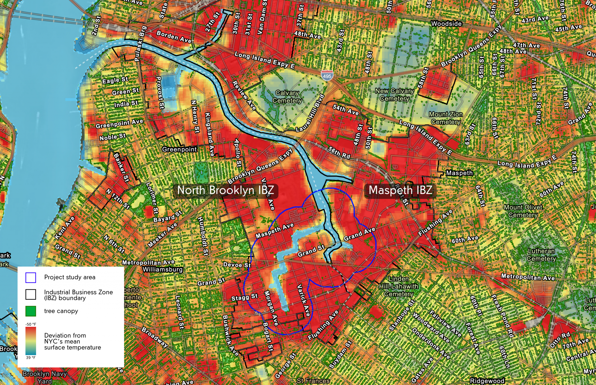
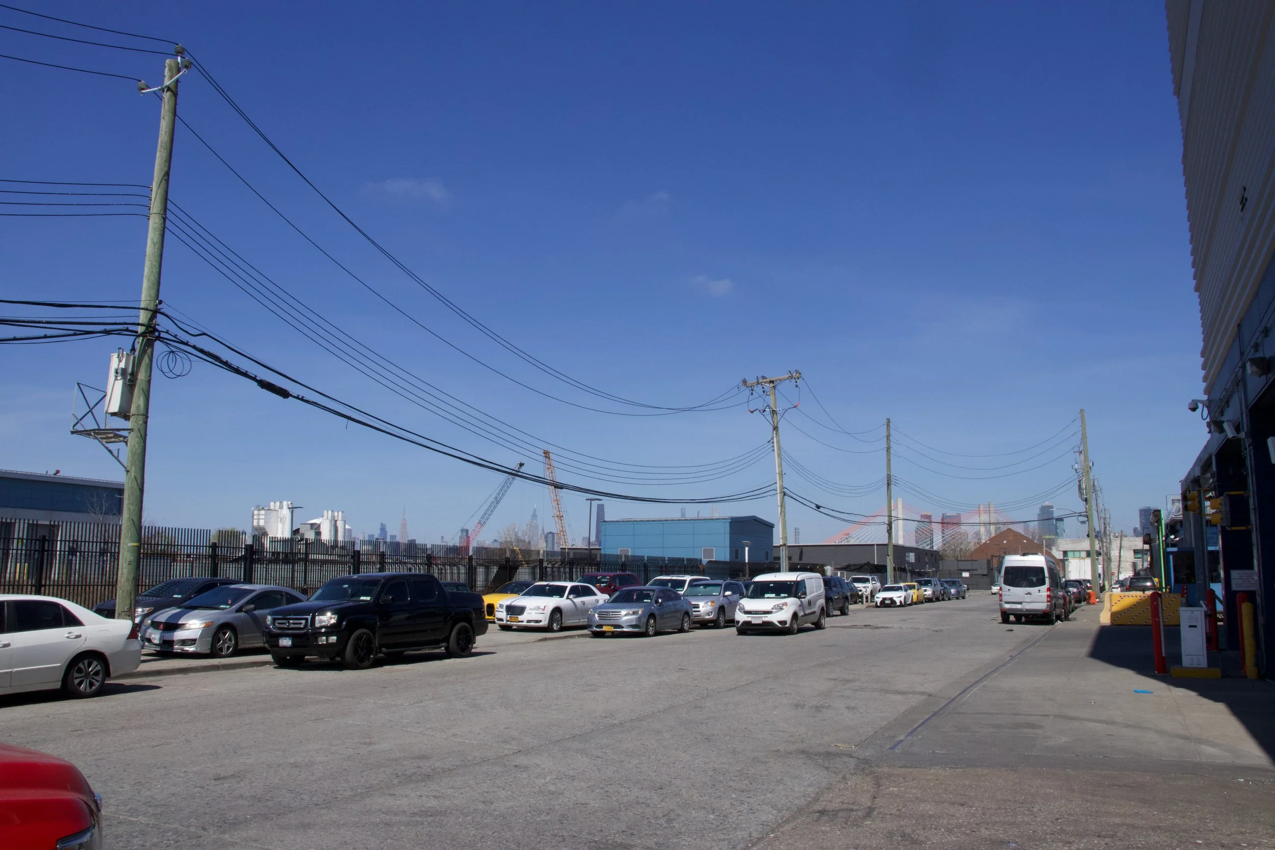
Left: This heat map of the creek shows heat anomalies and tree coverage in the areas around the creek.
Right: A treeless street in Maspeth, one block away from Plank Road Public Shoreline, a rare public access point on the creek.
There are few community gathering places near the creek; the area lacks parks, cafes, libraries, schools, and subway stations. Industrial polluters are able to hide the immense damage they've done to the creek because there are few residential buildings and limited pedestrian access. Newtown Creek Alliance has amended some street ends along the creek into public parks, but workers and residents often struggle to access them, either for lack of transit and safe streets, or from physical barriers like cars and other equipment parked on the sidewalks. If there's no place people feel enticed to hang out during a lunch break, or spend time with friends and build community, it’s much harder to see the damage or advocate for its redress. But just because something is hidden doesn’t mean it’s invisible.
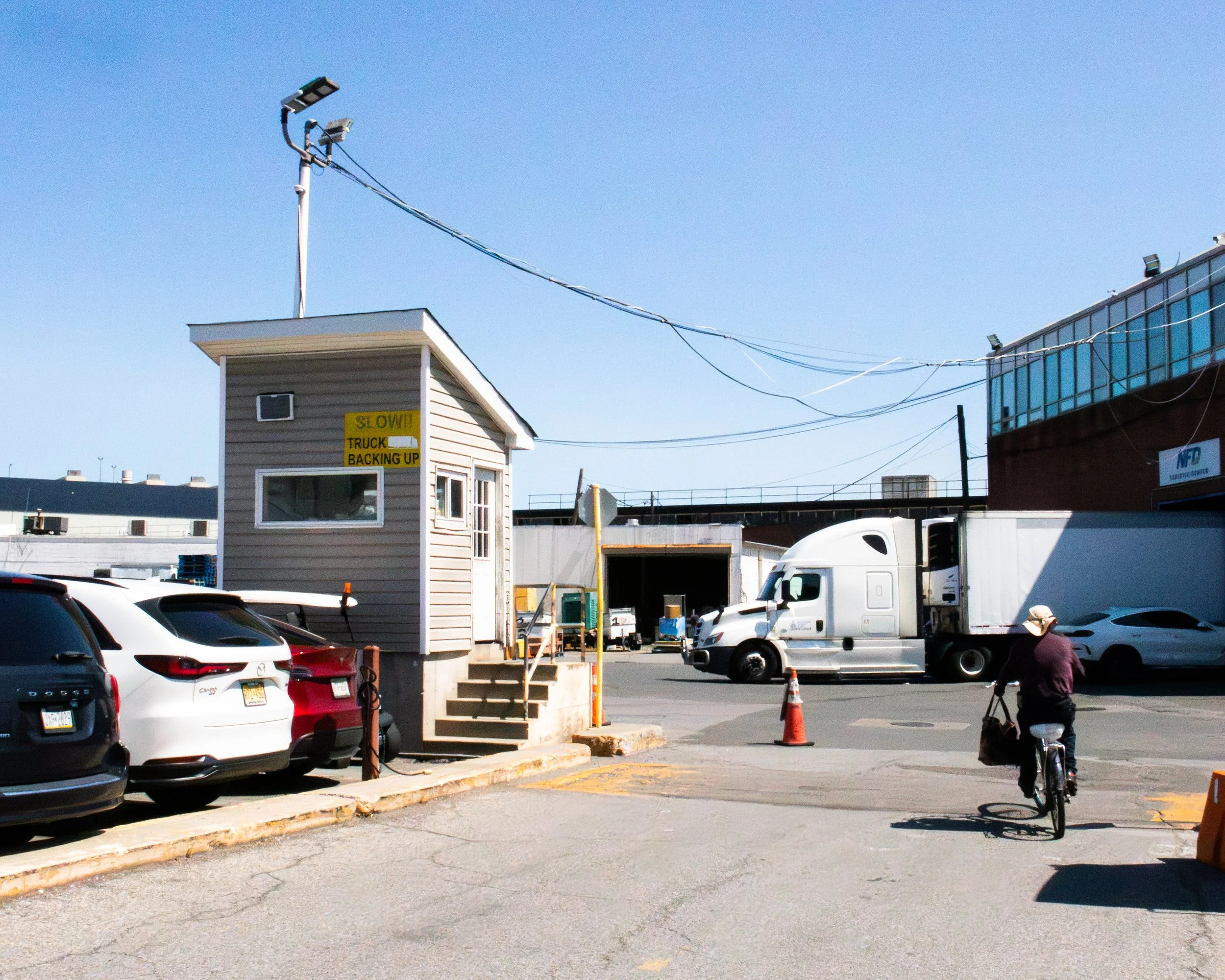
Left: Cyclist cutting across the Western Beef parking lot to get from Metropolitan Avenue in Ridgewood to Grand Ave in Maspeth. This route saves about 15 minutes of biking and protects riders from dangerous truck traffic.
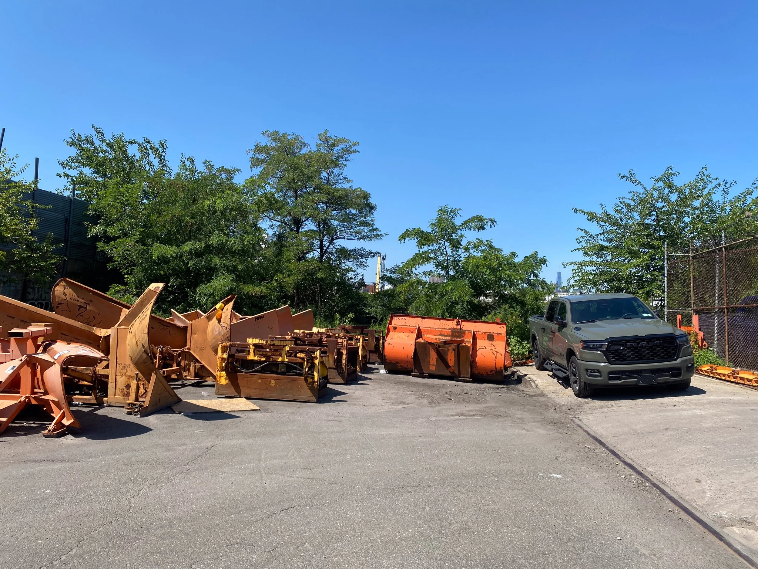
Right: Sanitation Department plows and a parked pickup truck block pedestrian access to one of the Plank Road Public Shoreline, a park maintained by Newtown Creek Alliance and one of the few public access points to the creek. I asked a woman who works about a 3 minute walk from here if she ever takes her lunch at the small park: “I would like to go, but Sanitation has it blocked off”.
I’ve lived in neighborhoods bordering the Newtown Creek my whole life. The Greenpoint apartment building I grew up in was built on former marsh land of the creek according to this NCA map. Despite a lifelong proximity to the creek (only a ten minute walk!), my quiet, treelined street was a world away. The stories my family told me about the creek’s unimaginable pollution, along with the powerful smell of the creek wafting onto our street, made it seem haunted - and also pretty gross. Because I never saw the creek up close, it lived only in my imagination as a dangerous place I wasn’t allowed to go and would certainly never be able to swim in. To my young self this made the creek useless, so I dismissed it and resolved that the sprinklers at the park would have to do for cooling down on a hot day.
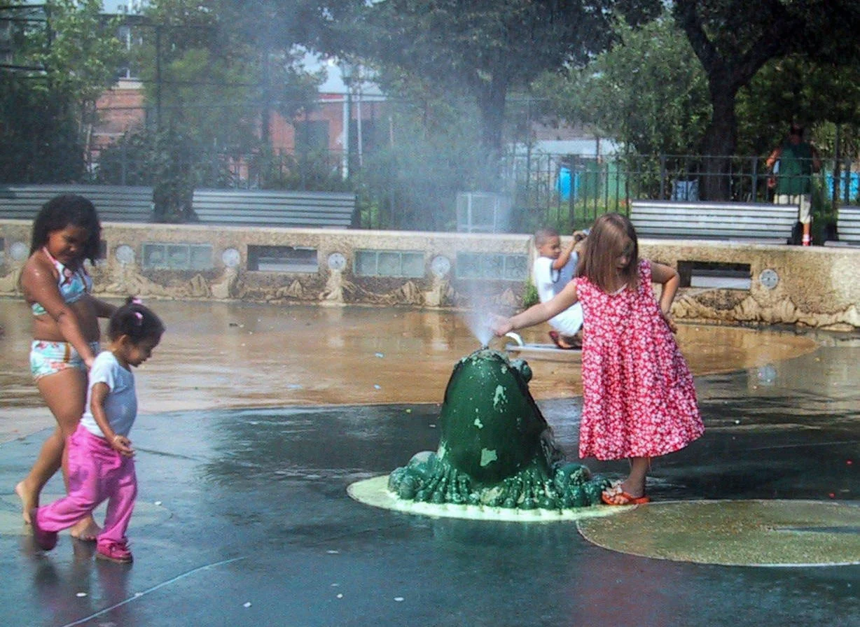
The author (right) playing in the sprinklers at McCarren Park c. 2005.
My relationship to the creek had already changed a great deal when I joined the Melting Metropolis team. I had already been thinking and making work about the creek for several years. This perspective shift was only possible because of the decades of advocacy and restoration work by community members and organizations like Newtown Creek Alliance, creating public access points along the creek and holding community events to bring people closer to the water. I’ve approached this project as a way to further make visible the creek’s histories to myself and my community, by looking at image collections in public archives, walking in the Industrial Business Zones along the creek, interviewing workers and residents in the area, and taking lots and lots of pictures. In June, I recorded an oral history interview with Lily Slivka, longtime IBZ resident and one of my closest childhood friends. When I asked her about how she manages to stay cool in the summer, she shared a practice that felt poignant and meditative.
“I've recently… been into standing on the corner and looking kind of forlornly at the horizon and just imagining everything when it was marshland. But I feel like I've been doing that a lot whenever I get really overwhelmed by how much human craziness is going on. I'll just stand on the corner and stare off at the sunset and just try to imagine everything as marshes and streams and greens.”
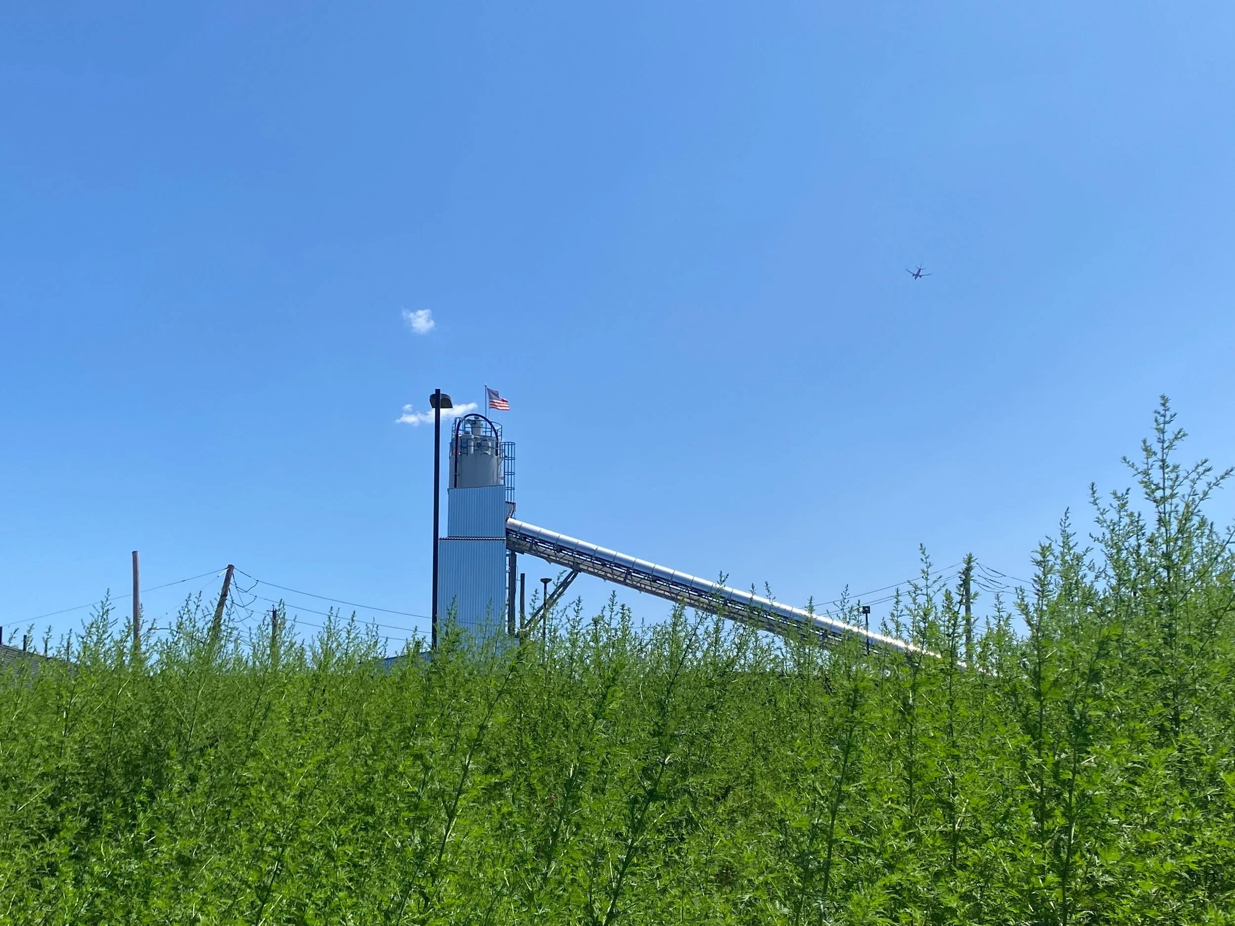
Left: View of concrete plant across a field on the shoreline of the creek.
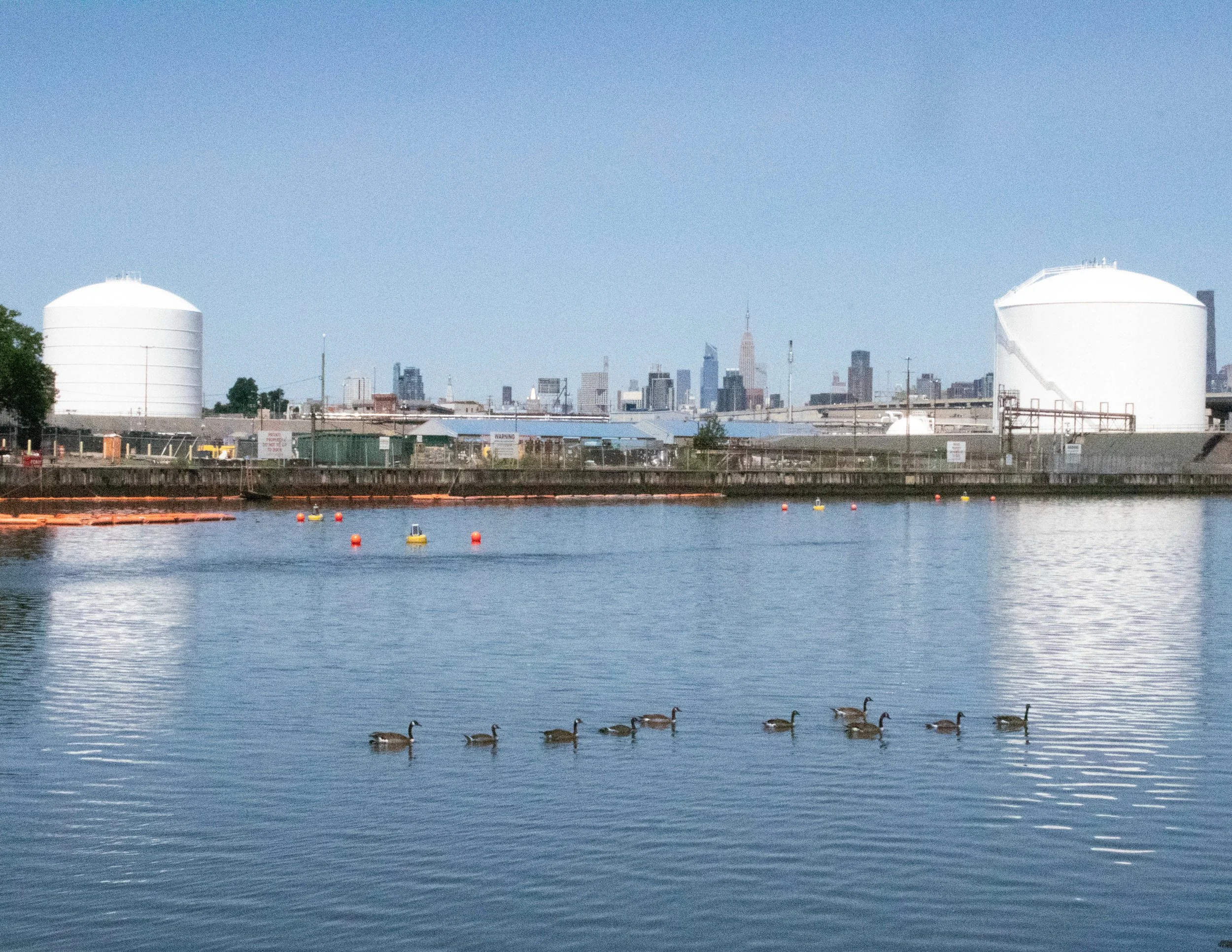
Right: A flock of Canada geese swimming in the creek, with fuel storage tanks and the Manhattan skyline in the background.
I was really struck by Lily’s imagining practice - finding mental refuge when a physical one is not immediately available is such a powerful strategy. It resonated with my own approach to visual research, of finding glimpses of the city as it once existed in public archives and expanding the field of vision by translating the images into larger artworks. There’s still a lot of beauty around the creek if you have the time, willingness, and capacity to look for it. There’s something strangely rural about parts of the creek; places appear displaced in time and space, you might almost forget you’re in the middle of one of the biggest cities in the world. It was not very long ago that this place was in fact rural.
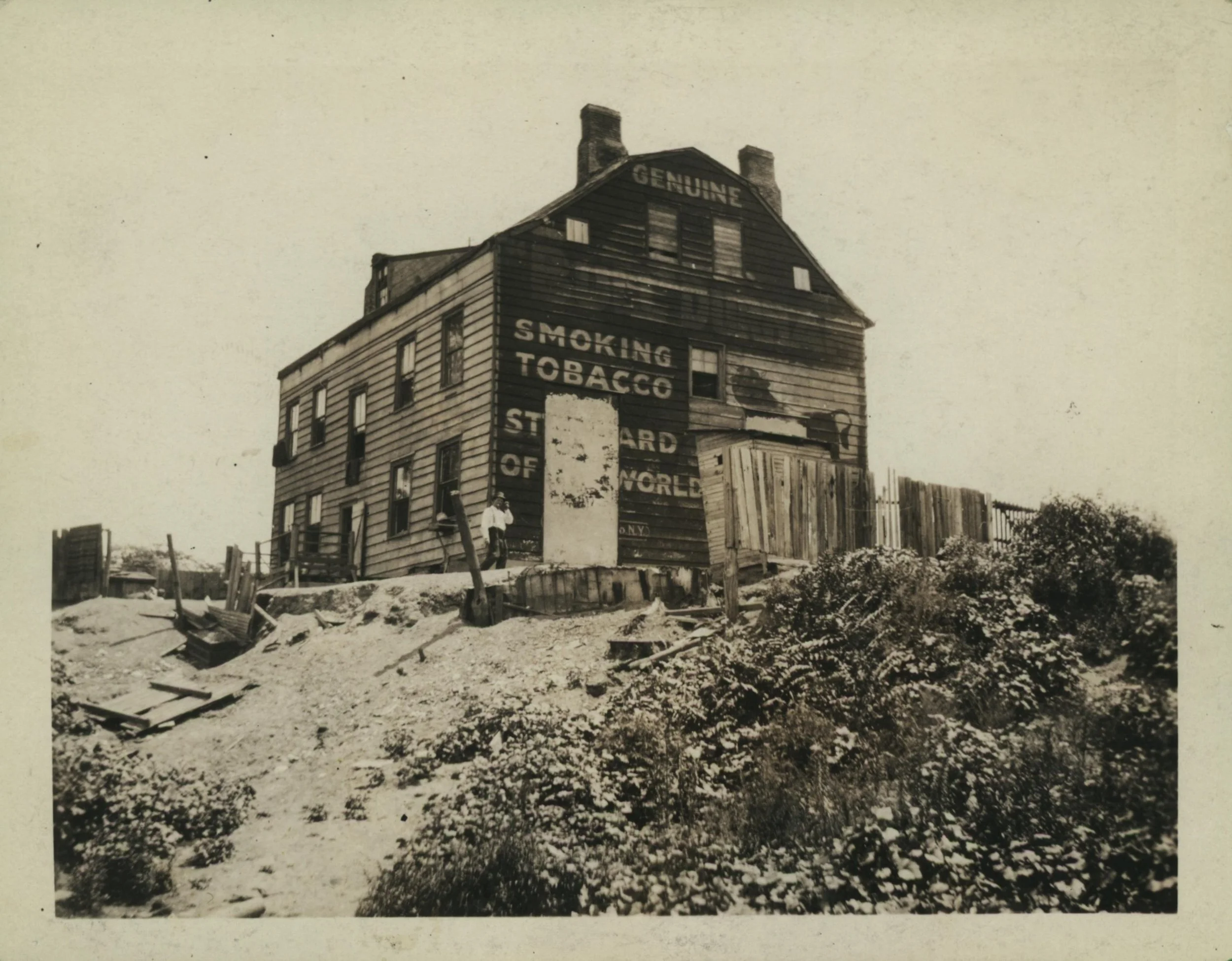
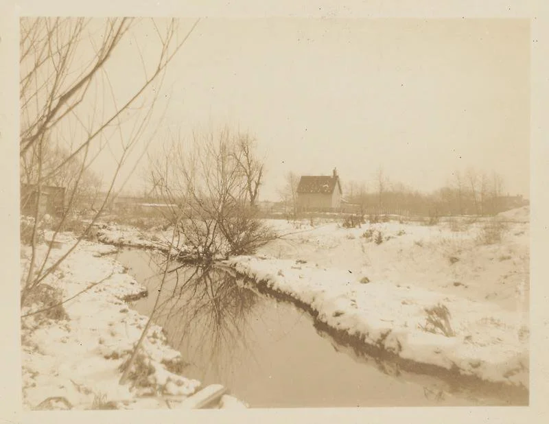
Left: Eugene L. Armbruster. 1922. Governor Dewitt Clinton House. Black and white photograph, QPL Digital Archive. It’s said that Dewitt Clinton got the idea for the Erie Canal at his country estate on the banks of the creek (pictured here).
Right: Eugene L. Armbruster. February 1924. Newtown - George Debevoise House From Across Old Brook. Black and white photograph, QPL Digital Archive. This section of the creek was infilled a few years after the photograph was taken and is now part of the IBZ.
Imagination alone won’t restore tidal marshes or create better working conditions, but it offers a way for us to envision that these things are possible. From my position as an artist, I can invite people to conceive of a world in which industrial places exist alongside natural refuges, for the benefit of workers, residents, and visitors. I’ll share more about my work with community through workshops and collaborative artmaking soon.