
How Green Became the Story
Siobhan writes from the Somers Town Community Association about how trees, plants, and shade in Somers Town have become the forefront of her creative practice.
Improvising
I began by asking people in Somers Town about their memories of heat. I did not expect water, plants, gardens, and trees to become the focus of my project—but, as the summer continued, they became impossible to ignore.
I asked people simple questions. What are your memories of hot summers? Where did you go to cool down? Where did you find shade?
I treated those first conversations as a starting point. I wanted to improvise, listen and follow what kept drawing my attention. Gradually, the project began to reveal its own direction.
Looking Above and Below
At the beginning of the research, I found myself becoming completely absorbed in maps. I looked at the Mayor of London’s Climate Risk Map, Greenpeace’s thermal images of central London, historic aerial photographs of Somers Town and Euston, and Charles Booth’s nineteenth-century poverty maps.
Looking from above changed the way I saw the area. Instead of viewing one street or tree at a time, I began to notice the canopy and the relationships between housing, roads, railway land, and green space.
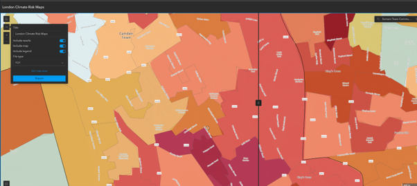
Mayor of London Climate Risk Map centred on Somers Town. Darker red areas indicate greater combined climate risk. Screenshot accessed September 2026.
The Climate Risk Map was difficult to understand at first, but it felt important. Parts of central Somers Town fall within the highest category of heat risk. In one representative part of the neighbourhood, tree canopy covers only around 2.7 per cent of the area, while the map also records a lack of access to public open space.
The map combines environmental conditions with social factors including income deprivation, social housing, age, and language. It shows that extreme heat is not experienced equally. People living with fewer resources and less access to shade and green space are likely to face greater risks.
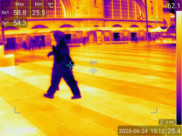
King’s Cross Square, 24 June 2026. Paving temperature: 54.3°C. © TI Thermal Imaging / Greenpeace. Editorial use only.
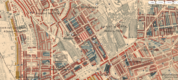
Charles Booth’s poverty map centred on Somers Town, showing Euston, St Pancras, Cranleigh Street and the area around St James’s Gardens, 1898–99. Screenshot from the LSE Charles Booth interactive map, accessed September 2026. Explore the map here.
The Booth map and the Climate Risk Map were made more than a century apart and measure different things, so they cannot be compared directly. Yet placing them together made the geography of vulnerability visible to me. Climate risk is arriving on a landscape already shaped by poverty and unequal access to healthy surroundings.
A Radical History of Light, Air, and Gardens
Looking at the poverty maps also led me back to Somers Town’s remarkable social-housing history. By the late nineteenth century, overcrowding was severe, with whole families sometimes living in a single room.
In the 1920s, Father Basil Jellicoe, Irene Barclay, Percy Maryon-Wilson and others formed the St Pancras House Improvement Society. They wanted to replace overcrowded and unhealthy housing without breaking up the existing working-class community. Their belief was that “housing is not enough.” People deserved not only affordable homes, but light, air, gardens, art, and places where community life could continue.
The nearby Ossulston Estate, built by the London County Council and influenced by pioneering Viennese social housing, formed another part of this transformation. Its homes were arranged around communal courtyards and small greens. These gardens were not decorative luxuries. They belonged to a radical idea of what healthy urban life should provide.
Nearly a century later, these gardens and their mature trees have acquired another importance. During extreme heat, they help cool homes, streets and gathering places. I began to wonder whether the original social promise of Somers Town — to give ordinary people access to light, air and green space — is being protected or gradually taken away.
A Change of Focus
By the time of the Somers Town Festival on 11 July 2026, the maps had already begun to change the direction of my research. I went to the festival intending to photograph local people with their dogs, but because of the heat, there were very few dogs. Instead, I noticed how much the trees mattered. Families had brought deckchairs and placed them beneath the canopy, where they could watch the performances in much-needed shade. The trees did more than provide relief from the heat; they helped create the atmosphere and made it possible for people to gather comfortably.
From Green to Yellow
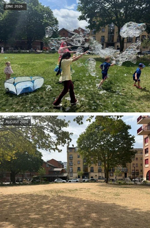
Polygon Road Open Space: Somewhere the Sun is Always Shining in June, followed by the same view after weeks of extreme heat and low rainfall in August 2026. Photographs: Siobhan Bradshaw.
At Somewhere the Sun is Always Shining in June, Polygon Road Open Space was green and full of life. Children ran through bubbles across the grass while families gathered beneath the mature trees. When I returned in August, the same view had been transformed. After weeks of extreme heat and very little rain, the green grass had turned yellow. The park was still being watered, but the strain of the summer was visible.
By then, London was in drought and a hosepipe ban was in force. The speed of the change shocked me. I had begun by asking people about their memories of heat. I had not expected water, plants, gardens and trees to become such a strong focus, but the summer itself kept bringing me back to them.
The contrast also made the mature trees appear even more important. The grass had changed within weeks, while trees grown over many decades continued to provide shade around the edges of the park.
How Somers Town Looked Without Trees
The festival and the changing park made me look again at how Somers Town appeared before its trees had grown. Photographs from the London Picture Archive show familiar streets and housing estates looking stark and exposed, with almost no canopy or shade.
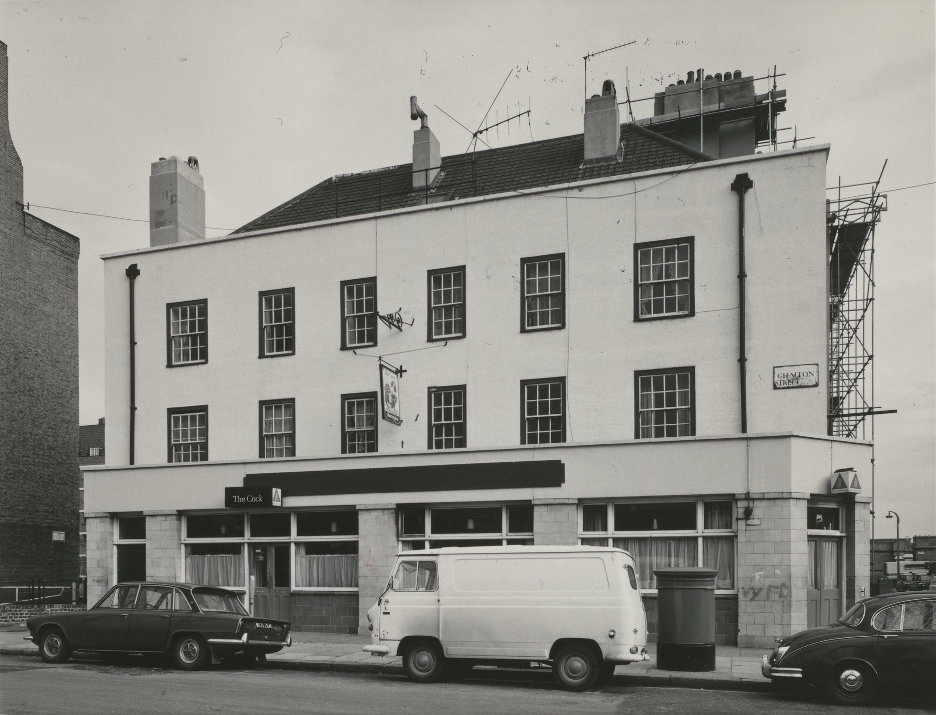
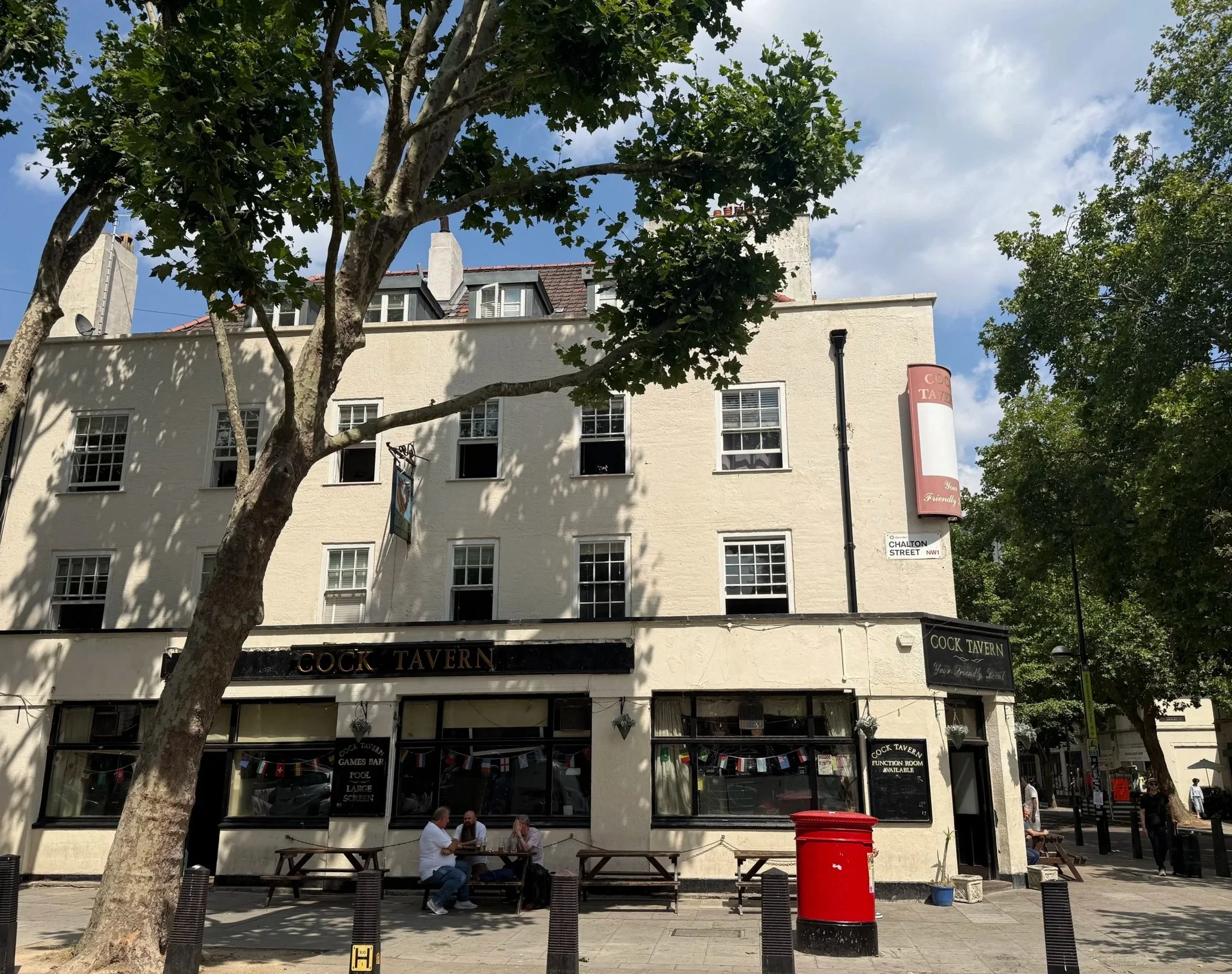
The Cock Tavern on Chalton Street, where I spoke with older residents during my research, in 1974 and 2026. The mature trees now provide shade around this important meeting place. Historic image: The London Archives; contemporary photograph: Siobhan Bradshaw.
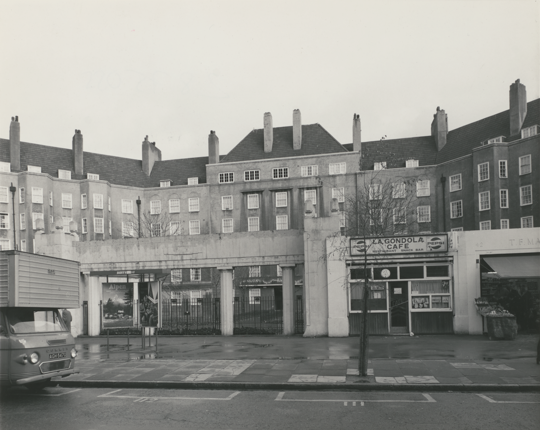
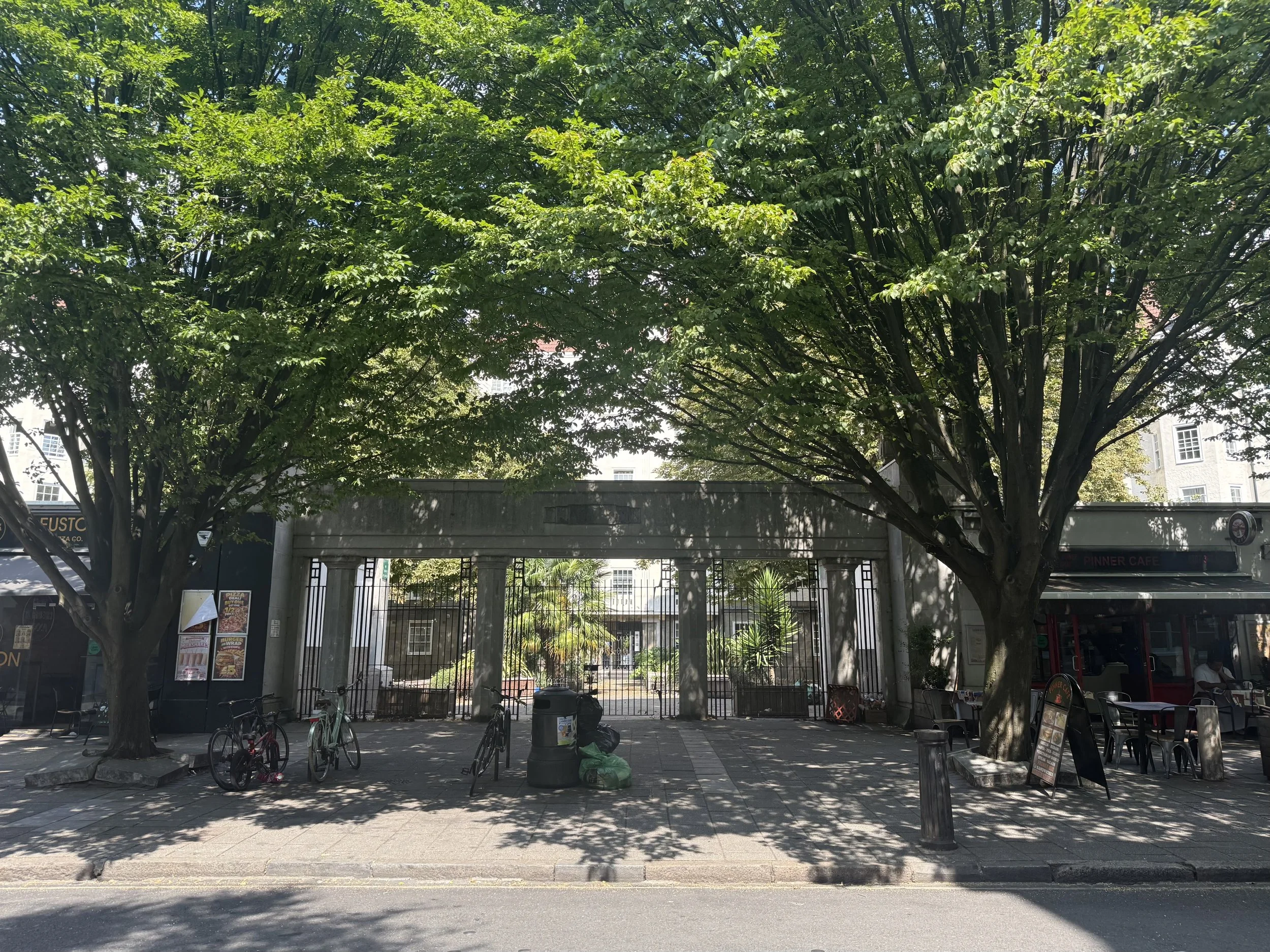
Somers Town estate entrance in 1937 and 2026. Historic image: The London Archives; contemporary photograph: Siobhan Bradshaw.
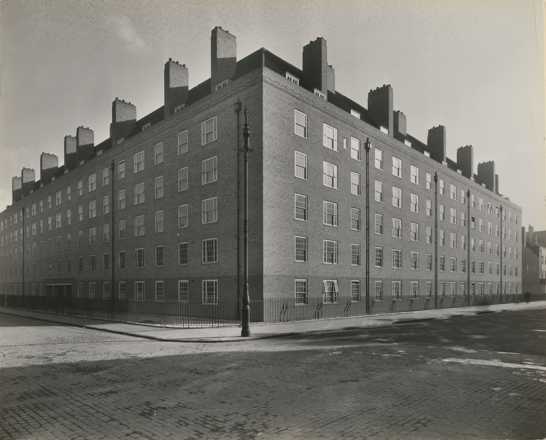
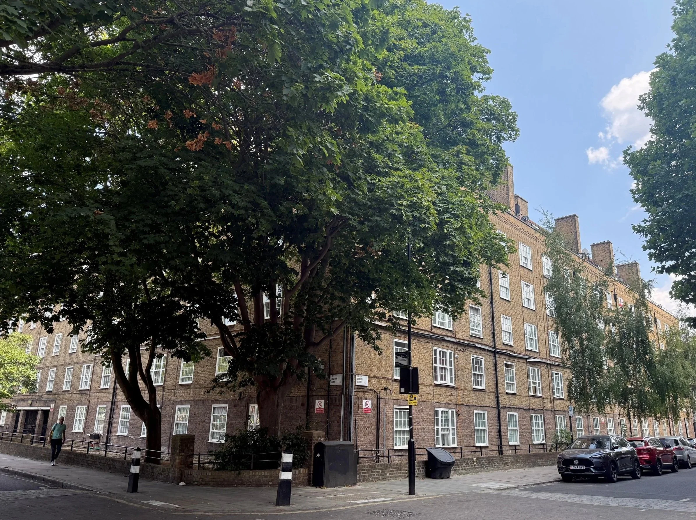
Somers Town housing in 1937 and 2026: decades of tree growth have transformed the street. Historic image: The London Archives; contemporary photograph: Siobhan Bradshaw.
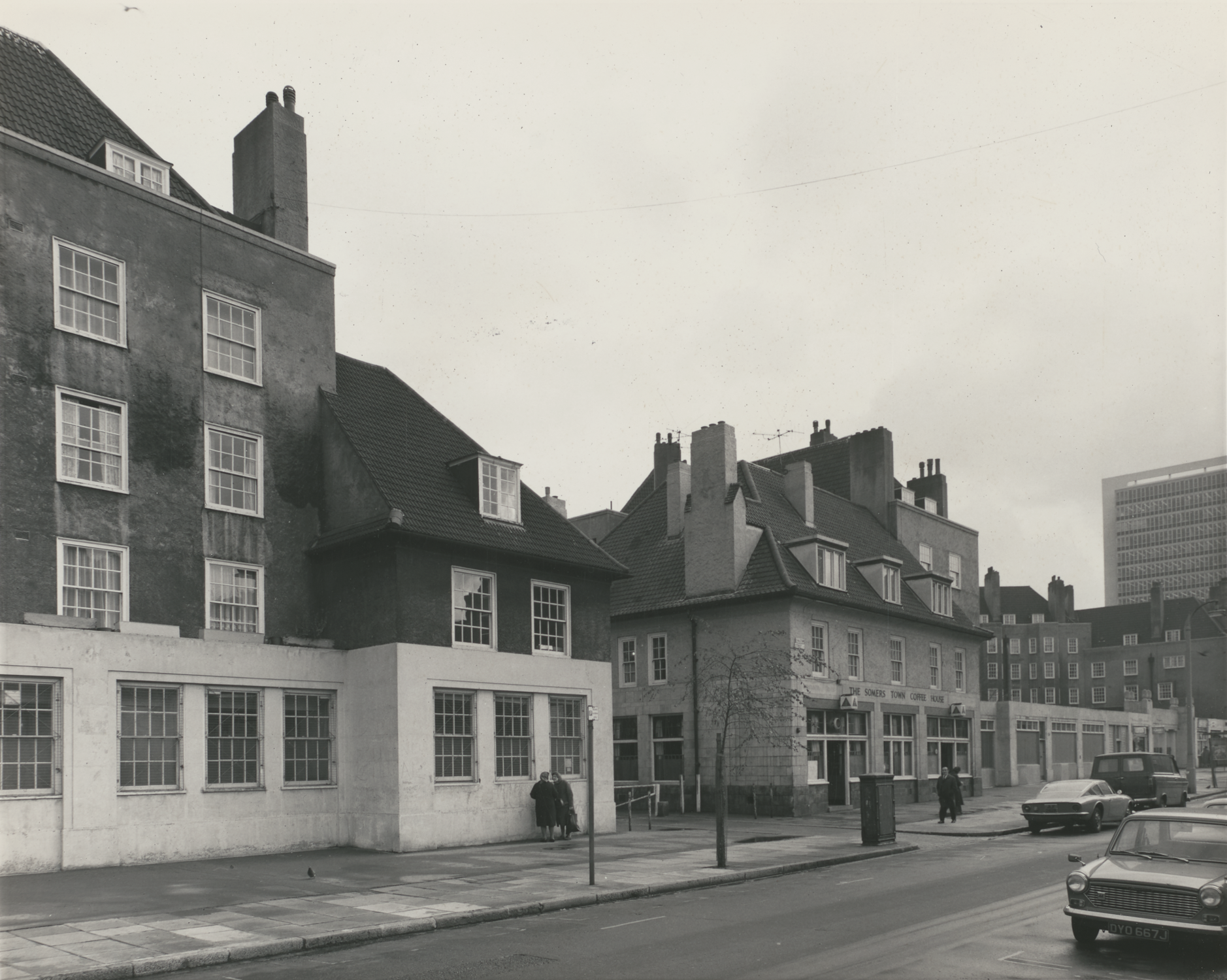
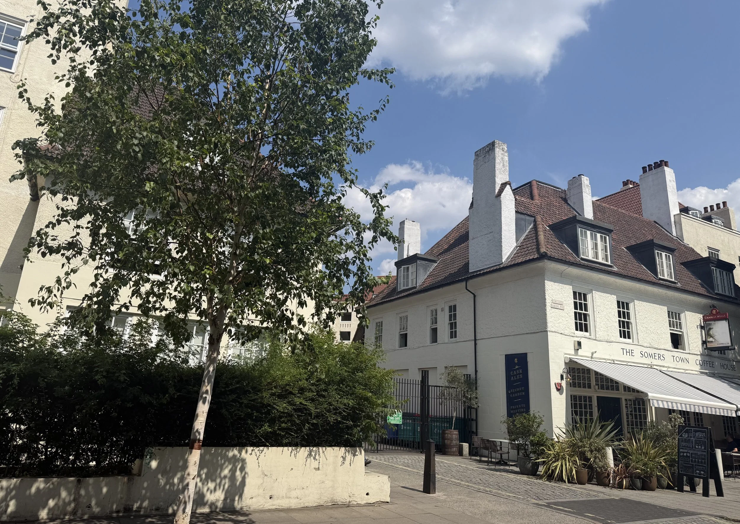
Beside the Somers Town Coffee House, 1972 and 2026. Historic image: The London Archives; contemporary photograph: Siobhan Bradshaw.
The contrast is remarkable. Mature trees now soften the buildings, shade the pavements, and create places where people want to pause and gather. These trees were not always here. Someone imagined them, someone persuaded others to plant them, and generations of people allowed them to grow.
The photographs show how slowly a green neighbourhood is created — and how much could be lost if its mature trees are not protected.
HS2 Development
In January 2021, during lockdown, I photographed protesters defending trees from structures in their branches and tunnels underground. It was bitterly cold and the ground had turned to mud. Later that year, while training as a citizen social scientist for Good Life Euston, I walked through the same area daily and observed how regeneration was affecting local people.
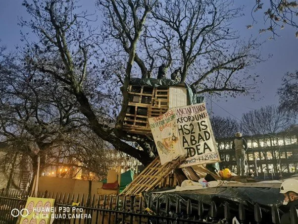
Tree protectors at Euston Square Gardens during the HS2 eviction, 27 January 2021. Photograph: Siobhan Bradshaw.
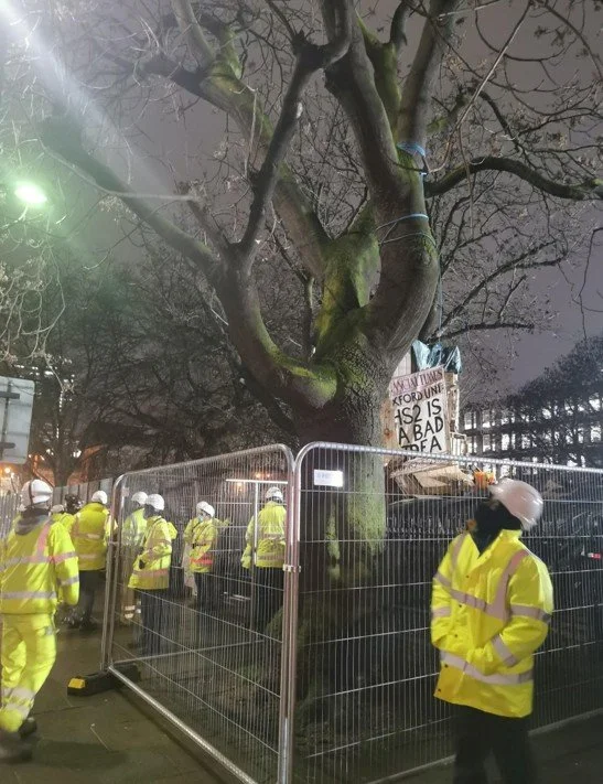
Security workers surrounding the mature tree during the eviction, 27 January 2021. Photograph: Siobhan Bradshaw.
BBC footage from the same day recorded the eviction. One tunneller later said that 31 days underground was “nothing compared to frying to death”.
St James’s Gardens disappeared for HS2. Residents then warned that the promised replacement had been reduced to an “insignificant” patch of temporary open space. Mature trees around Euston Square Gardens were later cut down shortly before work was paused.
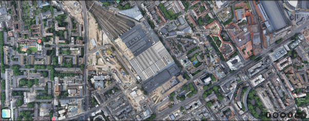
Euston seen from above. The HS2 construction site appears as a pale scar through the surrounding neighbourhood and tree canopy. Google Earth screenshot, accessed 1 September 2026.
A 2025 photographic survey found that little had changed across much of the site. Looking back from the heat of 2026, the protesters’ warning feels urgent: neither a sapling nor token landscaping can replace a mature urban garden.
I began to wonder whether a tree that has lived for more than 100 years should acquire a different status: held in trust for everyone who depends upon it now, and for those who will need its shade in the future.
A Growing Urgency
As the summer continued, the heatwaves intensified and trees appeared more frequently in the news. On 29 July 2026, after exceptionally low rainfall, sustained high temperatures and three heatwaves, the Environment Agency officially declared the whole of London to be in drought.
What had begun as a project about memories of heat was becoming something more urgent. The history of Somers Town’s gardens, the loss of mature trees around Euston, present-day climate risk and the people quietly caring for green spaces all appeared to belong to the same story.
Where the Research Is Taking Me
The photographs of Somers Town before its trees had grown made me think about the people behind this transformation. I had the pleasure of interviewing Herman, Mann, and Rosanna — three people who have imagined, encouraged, and cared for green spaces in and around Somers Town.
Decades ago, Herman persuaded the council to plant trees along local streets. Mann has spent years looking after the plants and trees along his whole street. Rosanna volunteers in her community garden, helping to care for a shared green space created by and for local residents. What struck me was that they had imagined a future — and we are now living in it. The trees, gardens, and shade we experience today began with people looking at an exposed or overlooked place and seeing what it could become.
As London faces hotter and drier summers, their stories feel increasingly important. They raise questions about who imagines, who plants, who cares — and whether we are protecting and creating enough green space for the people who will live here in the future.
Their stories will form the next part of my Melting Metropolis journey.
Sources and further reading
Mayor of London: London Climate Risk Map
https://www.londonpicturearchive.org.uk/
Charles Booth’s London poverty maps
People’s Museum Somers Town: Basil Jellicoe
Institute of Historical Research: St Pancras House Improvement Society
Environment Agency: drought declared in half of England, 29 July 2026
Britain from Above: historic Euston aerial photographs
BBC News: HS2 protesters occupy tunnels beneath Euston Square Gardens, 27 January 2021
Camden New Journal: 31 days in a tunnel is nothing compared to frying to death
Camden New Journal: promised public garden is an insignificant patch
Camden New Journal: mature trees cut down before HS2 work paused